Why Do Flights Curve? A Great Circle Route Map for Any Two Airports

I’ve worked at Turkish Airlines since 2013, and one question comes up again and again from friends looking at the seat-back map: “Why are we flying over Ireland on the way to America? Isn’t that the wrong way?” On a flat map it really does look like a detour. On a globe, it’s the shortest way there.
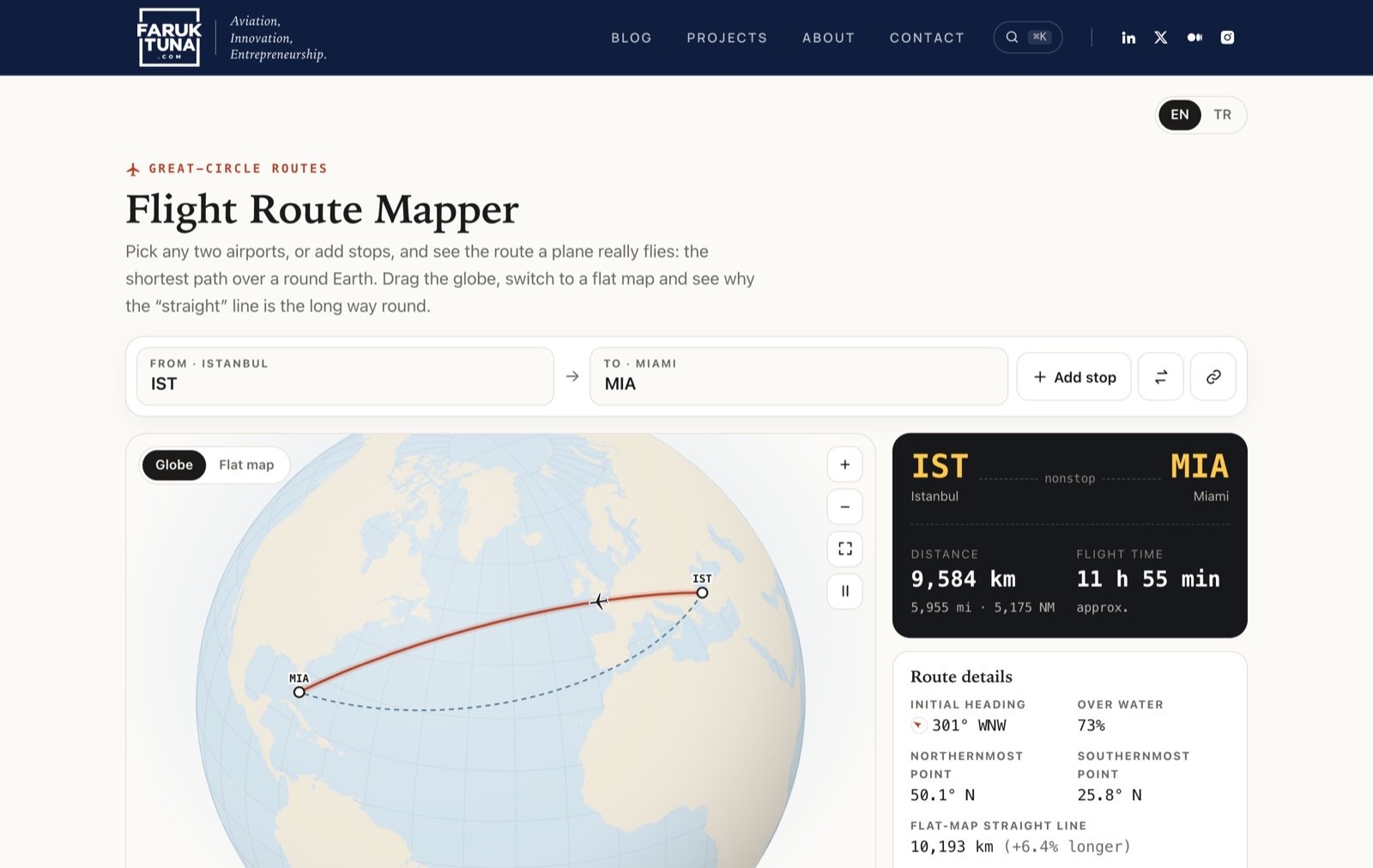
Flight Route Mapper is the tool I built to show the difference. Pick any two airports, or add stops, and it draws the great-circle route a plane actually flies, on a 3D globe you can drag around, together with the numbers behind it.
Try it nowIstanbul to Miami on a 3D globe · 1,185 airports · free, no sign-up
Open IST → MIA →
What is a great-circle route?
The Earth is a ball, and the shortest path between two points on a ball is not the line you’d draw on a paper map. It’s a great circle: imagine slicing the globe through its exact centre so the cut passes through both airports. The edge of that slice, where it meets the surface, is the great circle, and the shorter arc between the two airports is the shortest possible route.
The trouble is that we learn geography from flat maps. Most world maps stretch the far north and far south to make the round Earth fit on a rectangle. On those maps, a great circle between two cities in the northern hemisphere bends up towards the pole, so it looks curved and longer. The line that looks straight on the map is actually the longer one.
That’s why flights from Europe to North America pass near Iceland and Greenland, and why some flights between Asia and America cross the Arctic. The plane isn’t curving. The map is.
Real flights also bend around winds, airspace and approach paths, so they never follow the great circle exactly. But it’s the starting point every route is built from, and it explains most of the “why are we going this way?” moments.
Istanbul to Miami, in numbers
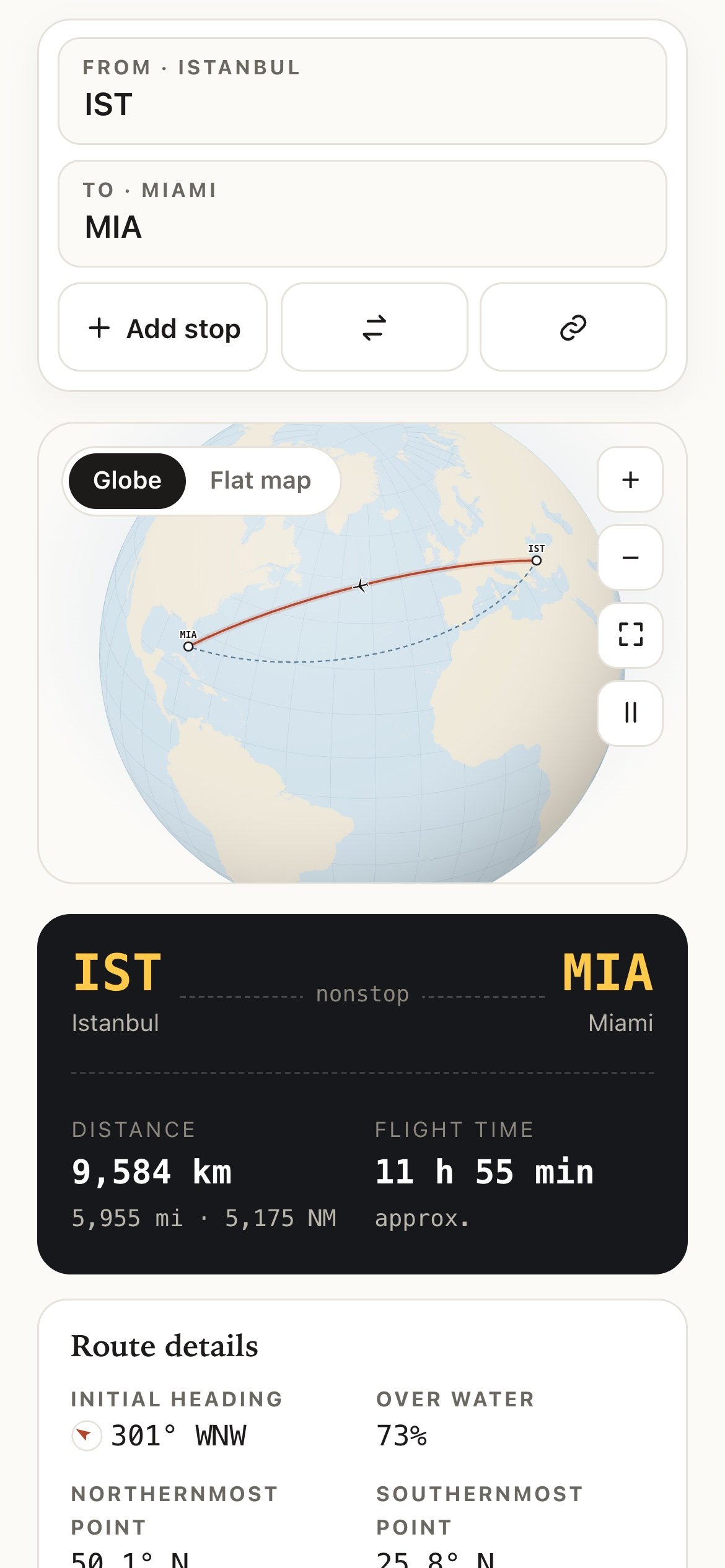
I like Istanbul–Miami as an example because the flat-map instinct is so strong: Miami is further south than Istanbul, so it feels like the plane should head west-southwest across the Mediterranean and the Atlantic. Here’s what the app shows for IST → MIA:
- 9,584 kmgreat-circle distance
- 11 h 55 minestimated flight time
- 301° WNWinitial heading
- 73%over water
- 10countries crossed
The initial heading is 301°, west-northwest. Instead of going southwest, the route climbs north over Europe and reaches 50.1° N before curving back down to Miami at 25.8° N. The countries along the way, in order: Türkiye, Bulgaria, Serbia, Croatia, Slovenia, Austria, Italy, Germany, France and the United States. After France it’s open Atlantic, which is why 73% of the route is over water.
The halfway point is at 48.5° N, 33.0° W, in the middle of the North Atlantic. The nearest airport the app knows is Ponta Delgada (PDL) in the Azores, and even that is 1,337 km away. The whole trip covers 23.9% of the Earth’s circumference.
The panel gives the distance in kilometres, miles (5,955 mi) and nautical miles (5,175 NM), since pilots and dispatchers work in nautical miles.
The flat-map view: why the straight line is the long way round
Next to Globe there’s a Flat map button. It switches to a familiar Mercator world map and keeps both lines on it, and this is the view that usually makes people say “oh”.
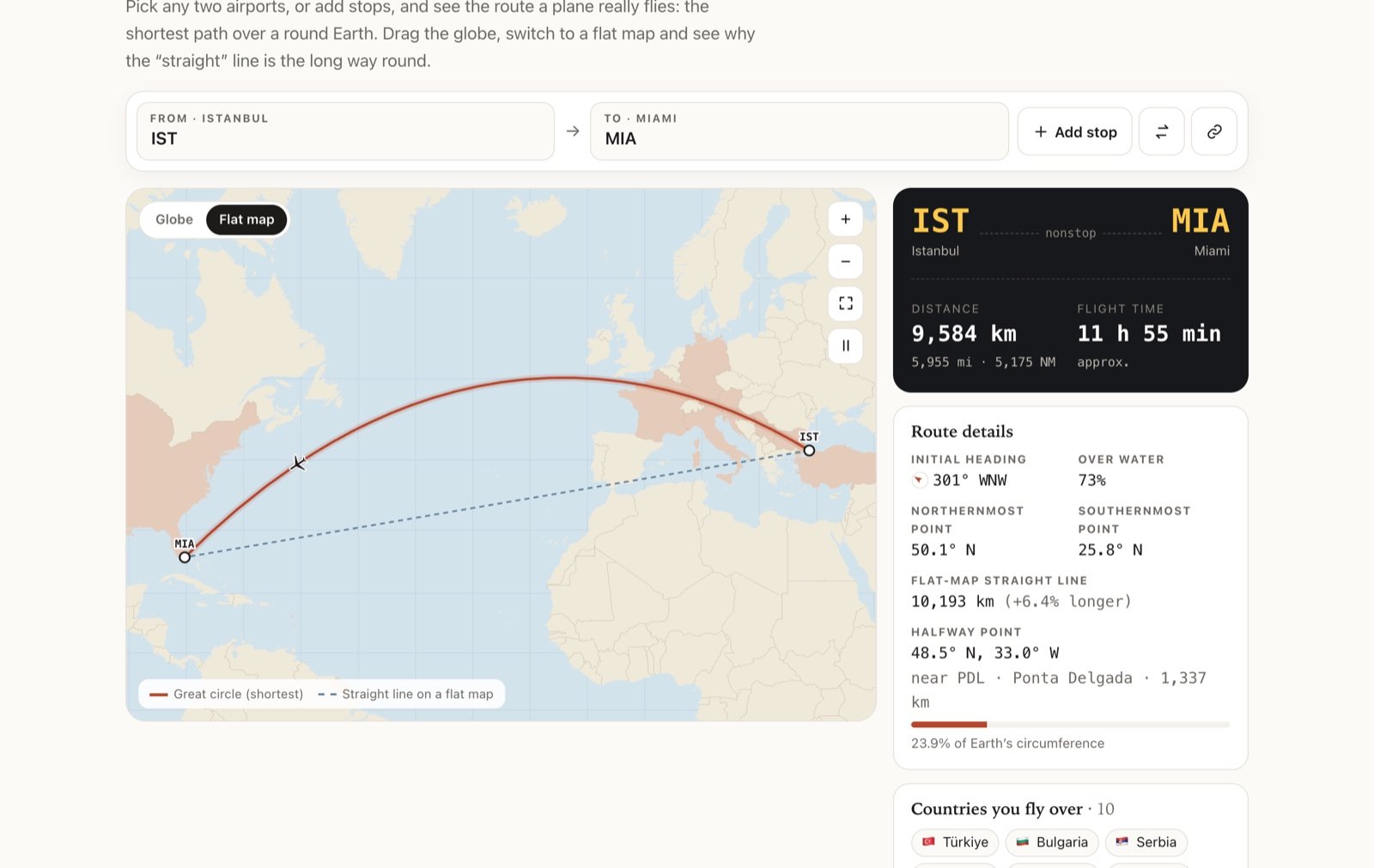
On the flat map, the great circle is a big arc over Europe and the dashed line is a neat straight line. The dashed line is a route with a constant compass heading, the one a ruler draws on this kind of map. The app measures it too: 10,193 km, which is 6.4% longer than the great circle. The countries the route crosses are shaded, so you can see exactly which land it passes over.
The further north the airports, and the further apart they are, the bigger the difference. For Istanbul to New York it’s 7.3%. For New York to Hong Kong it’s 26%.
Famous routes over the Arctic
Below the map there’s a list of famous routes to try, each with a one-line note. Tap one and the globe turns to it.
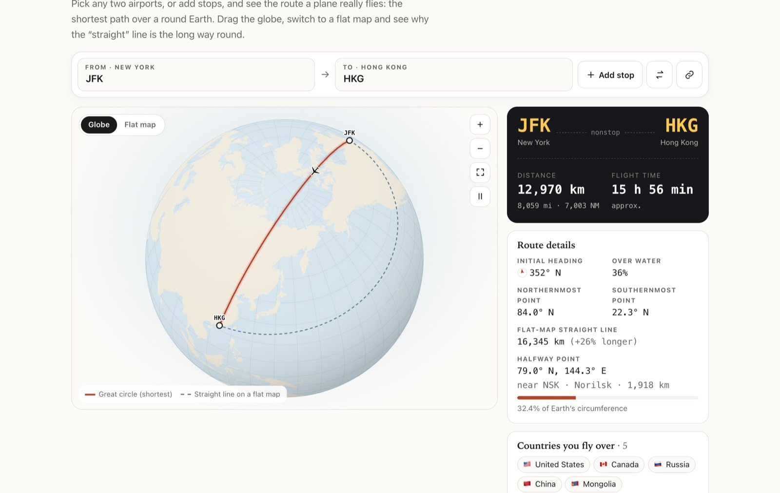
My favourite is New York to Hong Kong. You’d expect a plane to head west over the Pacific. Instead, the initial heading is 352°, almost due north, and the route reaches 84.0° N before coming down over Russia, Mongolia and China. The great circle is 12,970 km; the flat-map straight line would be 16,345 km.
Singapore to New York is similar: one of the longest nonstop flights in the world, with a great circle that reaches 87.5° N, close to the North Pole itself.
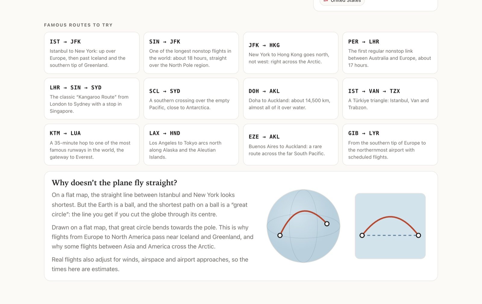
The list also includes Perth to London, Santiago to Sydney near Antarctica, Doha to Auckland, Los Angeles to Tokyo along the Aleutians, Kathmandu to Lukla, Gibraltar to Svalbard and a small Türkiye triangle of Istanbul, Van and Trabzon.
Multi-stop routes
Real journeys often have a stop, so the mapper lets you add them. Press Add stop, type a code or a city name, and the route redraws through it. You can have up to six airports in one route, remove any stop with the ×, and reverse the whole thing with the swap button.
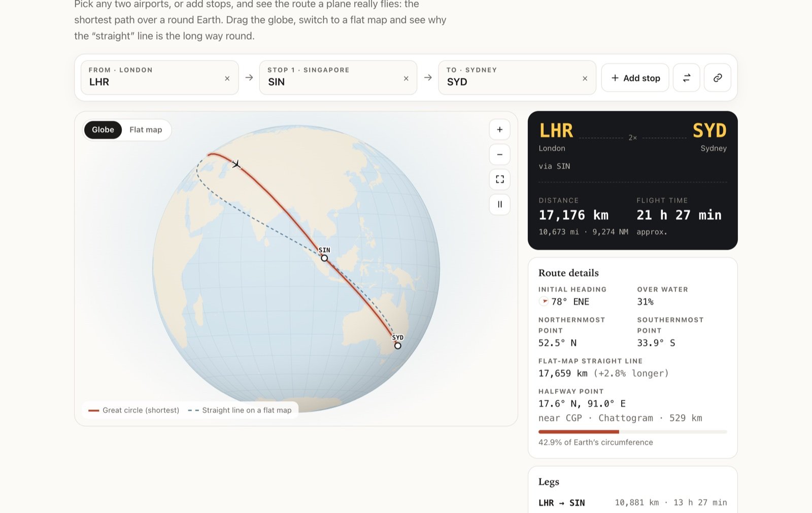
With more than one leg, the panel adds a Legs table and compares the trip with a nonstop flight. For London–Singapore–Sydney, the legs are 10,881 km and 6,295 km, 17,176 km in total. A nonstop flight would be 17,020 km, so the stop in Singapore only adds 1%. That’s the old Kangaroo Route’s secret: Singapore sits almost exactly on the great circle between London and Sydney.
The details panel
For every route, the panel on the right shows:
- Distance in km, miles and nautical miles.
- Flight time, an estimate based on a typical cruising speed plus a fixed allowance for take-off and landing. Real schedules depend on winds and airspace, so treat it as a ballpark.
- Initial heading, with a small compass, the direction the plane points as it leaves the first airport.
- Over water, the share of the route that isn’t over any country’s land.
- Northernmost and southernmost points of the route.
- Flat-map straight line, and how much longer it is than the great circle.
- Halfway point, with the nearest airport and how far away it is.
- Countries you fly over, with flags, in the order you cross them.
The countries and the water share are worked out by sampling points every few dozen kilometres along the great circle and checking which country outline, if any, each point falls inside.
Drag, zoom and share
The globe is fully interactive. Drag it to spin, use the scroll wheel or the + and − buttons to zoom, and the frame button to fit the route back into view. A small plane flies along the route; the pause button stops it.
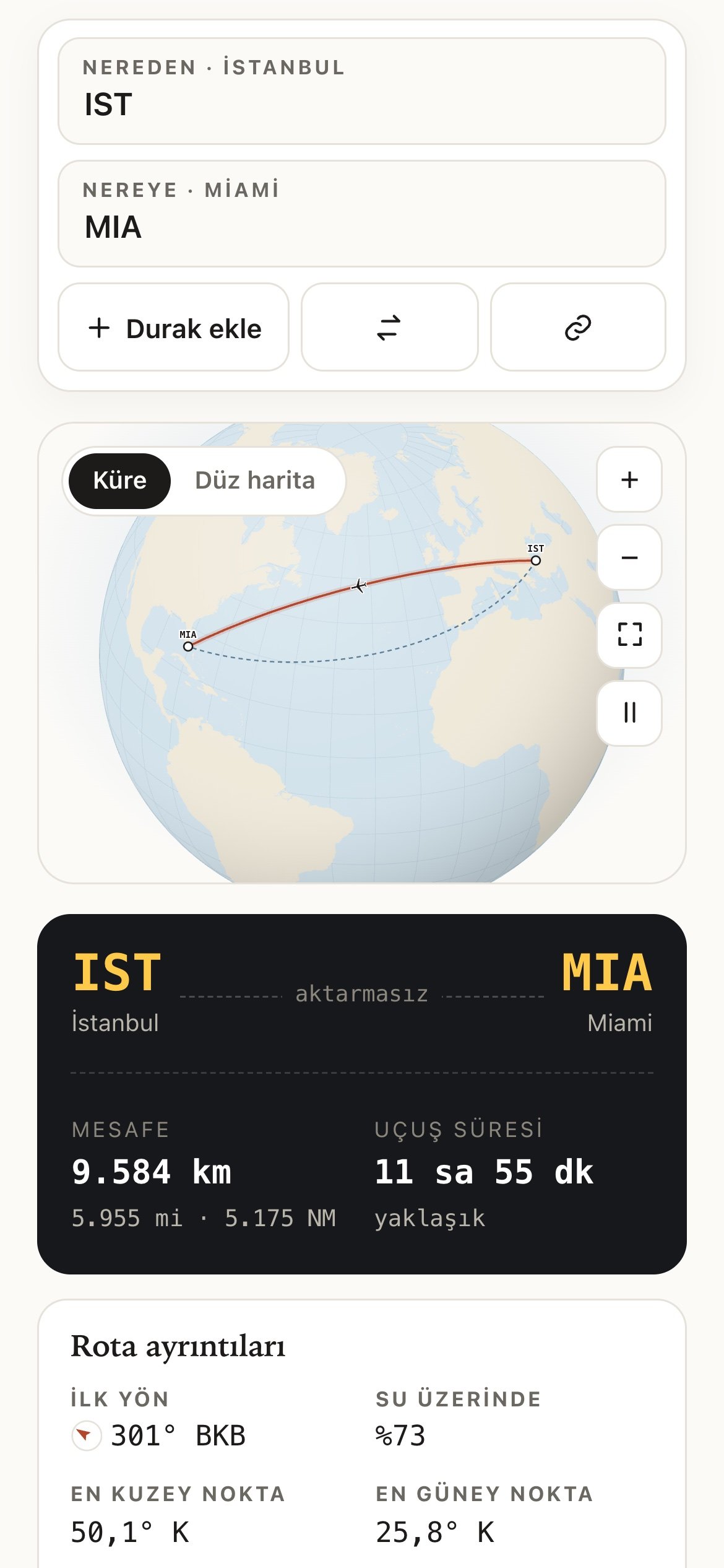
Every route has its own link. The airport codes go into the address after a #, separated by dashes, so /routes/#IST-MIA opens Istanbul to Miami and /routes/#LHR-SIN-SYD opens the Kangaroo Route. The link button copies the current route’s link so you can send it to someone. Like my other projects, it works on phones and it’s in English and Turkish, one tap away in the corner.
Next time you look at the seat-back map
If you enjoy this kind of thing, the Airport Quiz uses the same 1,185 airports and will teach you the codes, and Aircraft Spotter will teach you which aircraft is flying the route. Next time the moving map shows your plane heading somewhere that looks odd, put the two airports into the mapper and turn the globe. The plane is almost always on the short way round.
Where are you flying next?Type in two airports and see the route the plane really takes.
Open Flight Route Mapper →More aviation games and tools are on the projects page.
Builder and lifelong starter. At Turkish Airlines since 2013, founder of inovanadolu, PhD in innovation. I write about aviation, entrepreneurship, innovation and the new world order.
About me →

